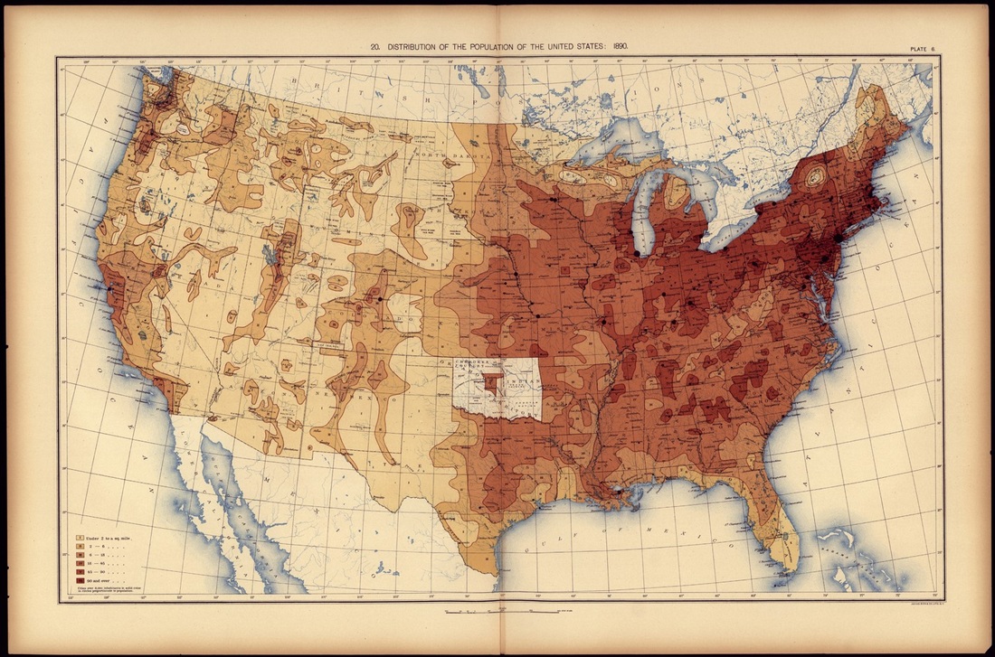
Map of the US population in 1450 Map of US population in 1890
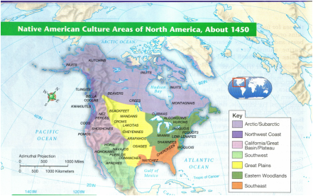
Map of the US population in 1820 As you can see on the United States density map of 1820, most of the population lived in the east. Then in 1890 more people were moved out west, so the population was less dense in the east. Because more and more white settlers were moving west and expanding the United States, many Native Tribes were forced out of there land. This caused tribes to be pushed out of their homelands. The Cheyenne tribe was split because of the white settlers taking their land. Although the total population of the Cheyenne tribe was unknown back then, there now are around 20,000 Cheyenne members. There are many differences between the Cheyenne tribe in the past and now.
During the beginning of the expansion west, the US only had one policy. It was that if white settlers wanted the Indians land, they could have it. The Indian tribes were pushed further west with great force. White settlers kept taking Indian land and forcing them to move. By the middle of the 1800s, most of the tribes were pushed west and were given territories. Cheyenne was split into two group and moved into Minnesota and Oklahoma. During the move many people contracted malaria in 1877. There were very poor conditions in Oklahoma, so Northern Cheyenne leaders made the decision to move their people north in 1878. The soldiers wanted them to move back to Oklahoma, so they deprived them of food, water, and heat. They became so desperate they scraped ice off of the windows to get moisture. Because they were forced to move, many Cheyenne died and the tribe was split up.